 |
Search for mineral resources
|

 |
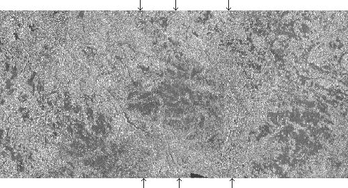
The combined radar imagery (5 passes) of the diamond and goldfields area
the "Severny bereg" (the Zolotitsa river basin, the northern
part of the Archangelsk region, Russia). It was acquired by the SAR-23
in L-band, simultaneously with the SLR-08


© CRSE, April 1998