 |
Operational evaluation of ice conditions, detection of broken-away floating ice, rescue the peoples |
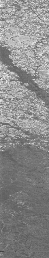
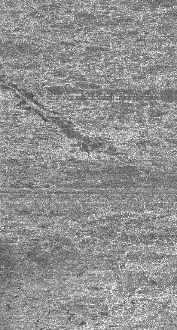
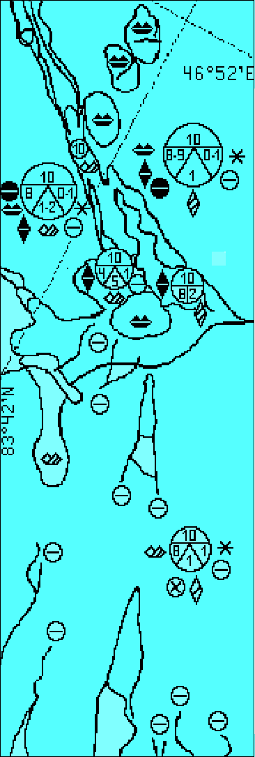
The radar imagery of sea ice, acquired by the Ka-band SLR-08 (left), the radar imagery of sea ice, acquired by the L-band SAR-23 (center), and map of sea ice conditions, generated from the synchronous radar data (right).
![]()
![]()
![]()
![]()
© CRSE, April 1998