 |
Earth surface observation |
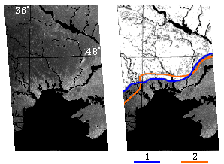
The image acquired by the SICH-1 radar on March 21, 1996 (left) and its processing which are pertinent to monitoring of the dynamics of the snow spread boundary. The processed image shows the overlaid snow cover spread boundary which was marked off using the SICH-1 data (1), and the in situ ground measurements (2). The data are clearly seen to be in good agreement. The utilization of the real-time radar data enables the snow melting dynamics to be monitored in the spring-time and the flood events to be effectively predicted.
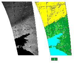
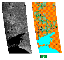
The radar images (black-white) and the processed images (color) which demonstrate the possibilities of monitoring the spatial distribution of precipitation. The two images (left) show the rain and snow precipitation (1) being observed in the Eastern part of Ukraine on December 28, 1995; the two other images (right) present the precipitation as rainfalls (2) on May 14, 1996. The use of the radar data for the spatial distribution of rain/snow fall-out monitoring makes it possible (taking into account the in-situ measurements) to obtain authentic data on the moisture reserves in soil, for crop forecasting, etc.
© CRSE, April 1998


